


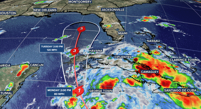
After a historically quiet tropical season, things are starting to pick up in the Atlantic. The current area of concern is in the Gulf of Mexico where Tropical Storm Ian is expected to gain strength, reaching major hurricane status by Tuesday.
The Usual Track Uncertainty
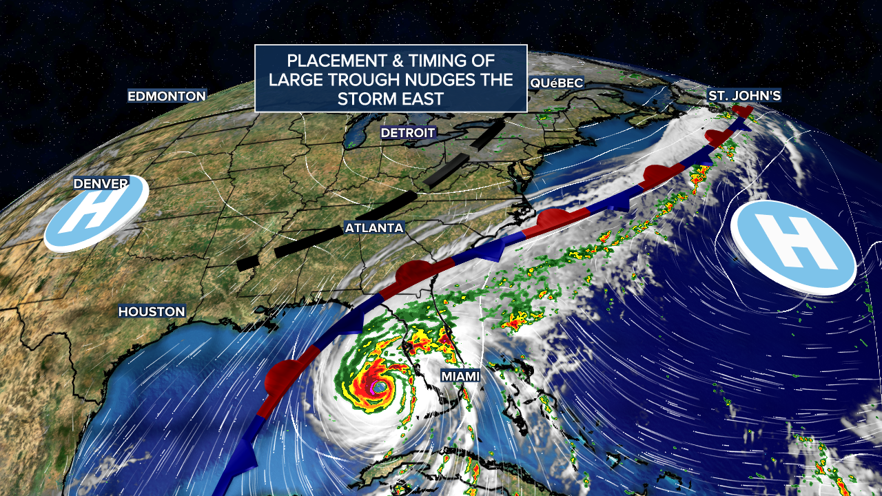
There are some questions regarding the track of this storm with the biggest one being how far "west" it will be once it reaches the gulf? This is crucial in determining Ian's impact on Florida and other gulf states. Right now, it appears the storm will favor an easterly track with Florida getting the worst of it. The idea behind an easterly track is due to the speed and placement of a trough at the 500mb level (roughly 16K - 20K feet in the atmosphere). This will serve as the primary driver for the hurricane to shift northeast after reaching the western coast of Cuba. The two large areas of high pressure will have minimal influence on the storm's path, but the high over the Atlantic could enhance the storms rainfall over the southeastern US.
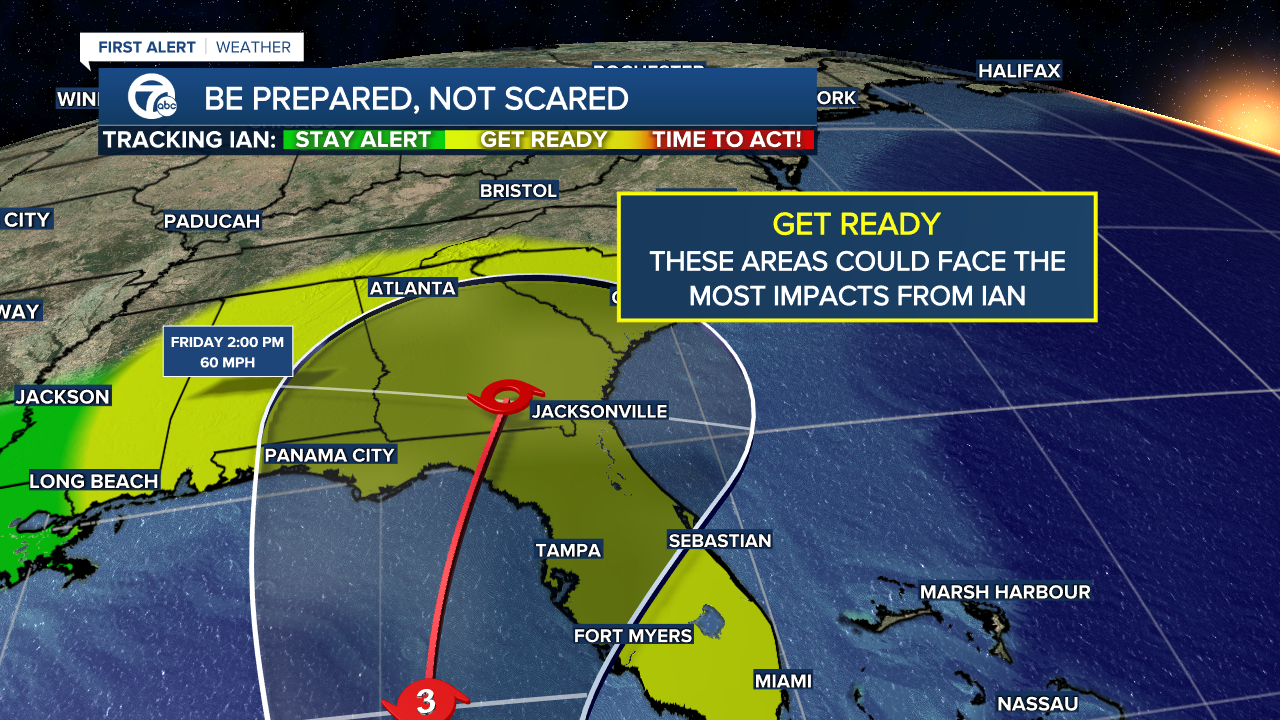
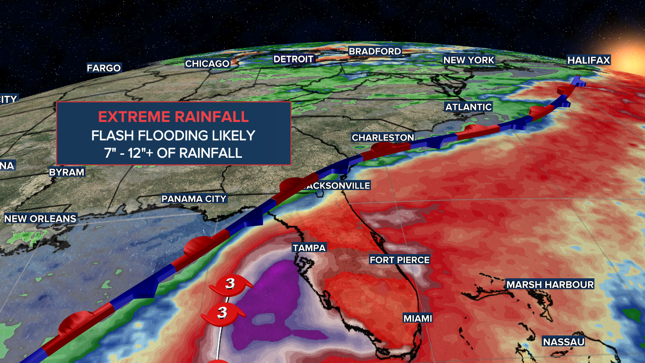
Our southeastern states are paying close attention to Ian for this reason. Even though its forecast to make landfall as a weaker hurricane, these storms are still capable of causing major issues like flooding, storm surge and damaging winds. Rainfall could be as high as 12"+ for some areas of Florida, the Carolinas and Georgia depending on Ian's track after landfall.
We'll continue to update you on the tropics and this storm as it approaches the US.
Detroit weather 7-day forecast
Connect with 7 First Alert Meteorologists on Facebook and Twitter:
Facebook: Dave Rexroth , Hally Vogel , Kevin Jeanes
Twitter: Dave Rexroth , Hally Vogel , Kevin Jeanes
