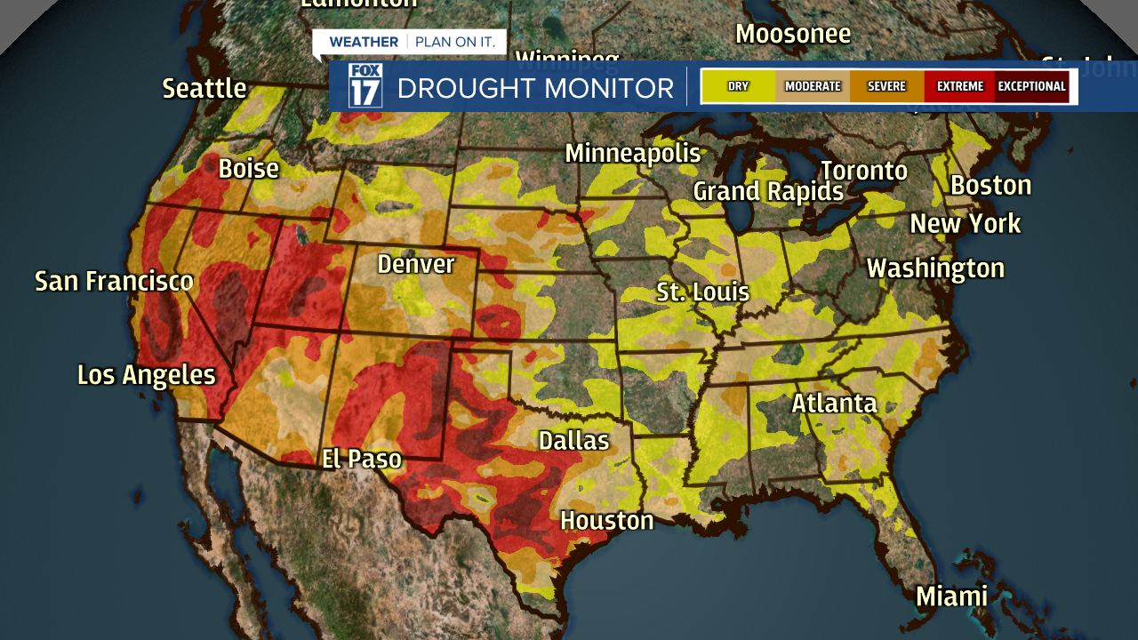
WEST MICHIGAN - Conditions across parts of West Michigan have been dry over the past several weeks, including through most of June. Earlier this week our southern counties got drenched by rain and thunderstorms along/south of the I-94 corridor, dropping between three and five inches. That said, our northern counties along/north of I-96 are now beginning to run ABNORMALLY DRY according to NOAA and their DROUGHT MONITOR.
The image attached to this story shows some of the "yellow" color being plotted north of Grand Rapids on the map. That's the beginning of a pre-drought stage in those areas, or technically ABNORMALLY DRY. While June was overly dry in these areas, the beginning of July hasn't been much better. We need rain! Take a look at the DROUGHT MONITOR for the entire United States below.

Areas like Grand Rapids (for example) only tallied 1.42" of rain in June. Normal would have been 3.94", so we're running a deficit of -2.52". A bit further north in Alma, precipitation from April through early July should have normally been 11.62". They only picked up 7.9", a deficit of -3.72".
Unfortunately, our next rain chance or thunderstorms (not a certainty but a chance) arrives on Monday as a cold front enters the region. Here again, I would expect some areas to be missed. Furthermore, the longer range outlook from NOAA's CPC or Climate Prediction Center shows a good chance (about 60%) of above normal temperatures from July 16 - 22. See image below.

The above map indicates that hotter weather may be coming for mid/late July, plus below normal precipitation during that same time frame. See precipitation image below.

Hotter than average temperatures, below normal precipitation, and the beginning of a drought...not a good combination as we may also see an increased fire danger or threat. Please exercise care/caution when burning or conducting campfires.
Get the complete West Michigan forecast at www.fox17online.com/weather.


