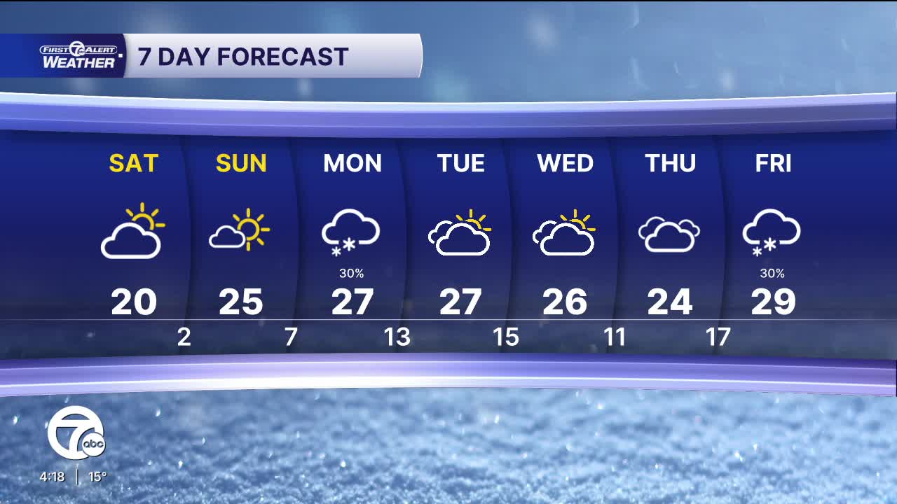


We're warming up this weekend, but we won't necessarily by warm. Highs climb into the low to mid 20s both days. Saturday will be cloudier with a few flurries, while mostly sunny skies return for Sunday.
High temperatures stay into the 20s next week. Some light snow is expected Monday, with up to 1" of accumulation. Midweek will be quiet, before more accumulating snow is likely Friday.
Check out the forecast:
Tonight: Increasing clouds. 1-3" of lake effect snow near Lake Huron possible. Lows in the low to mid single digits. Winds NW 5 mph.
Saturday: Mostly to partly cloudy. Highs near 20°. Winds: NNW 5-10 mph.
Sunday: Mostly sunny. Highs in the mid 20s. Winds: W 5 mph.
Connect with 7 First Alert Meteorologists on Facebook and X:
Facebook: Dave Rexroth , Hally Vogel, Marisa Woloszyn, Mike Taylor
X: Dave Rexroth , Hally Vogel, Marisa Woloszyn, Mike Taylor
Current Conditions
- Humidity: 69%
- Dew point: 1°
- Pressure: 30.37 in
- Wind speed: 5 mph
- Wind direction: W
- Visibility: 10.0 mi
- Sunrise: 07:47 AM
- Sunset: 05:45 PM
