

Fog is expected overnight and into Thursday morning. With lows in the low 30s a few spots may get freezing fog. Be careful during the morning drive, especially on ramps, bridges, and overpasses.
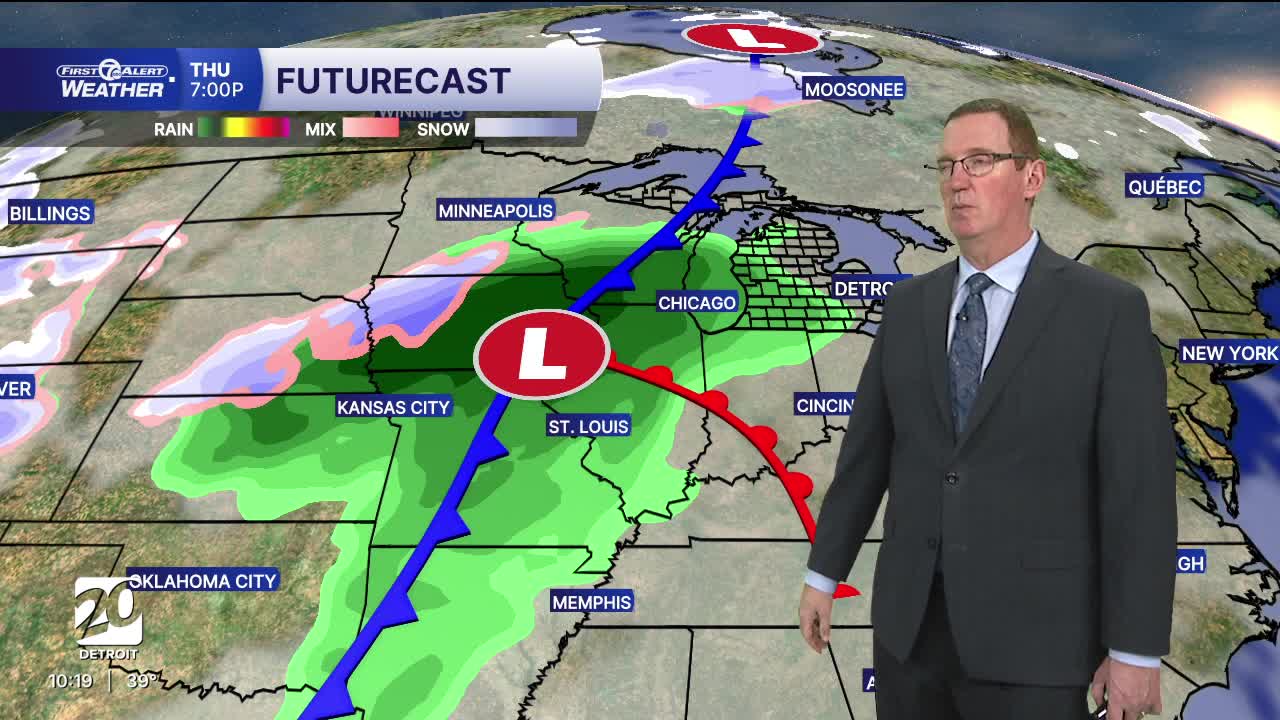
The real warmth kicks in starting tomorrow. Thursday's highs will be in the upper 40s under mostly cloudy skies. The day should start dry, but rain chances increase late in the afternoon and evening. Winds will turn southerly helping to boost temperatures. By Thursday night periods of rain become more likely and more widespread.
Friday is really warm with highs in the 50s with 56° in Detroit ahead of a stronger cold front. If we do get to 56° in Detroit it will be a new record high for January 9th! Temperatures will warmer through midday than by late in the day.
A few showers will be possible in the morning. The afternoon is likely to be drier than the morning.
Another system moves through this weekend. It could become quite strong. Saturday showers should be mostly rain, but as colder air returns Saturday night and Sunday there should be a change to snow showers. Highs will be in the low 30s Sunday with strong winds.
Watch the full forecast
Tonight: Mostly cloudy with more fog possible and temps around 32° or just below. Freezing fog could become a concern in spots outside the city of Detroit. Winds: S 5-10 mph.
Thursday: Mostly cloudy with a chance of rain late in the day. Highs in the upper 40s. A few spots may hit 50°. Winds: S 10-15 mph.
Friday: This will be warmest day in a long time with a record high of 56° in Detroit. Winds will turn towar the NNW in the afternoon at 10-20 mph behind a cold front.
Connect with 7 First Alert Meteorologists on Facebook and X:
Facebook: Dave Rexroth , Hally Vogel, Marisa Woloszyn, Mike Taylor
X: Dave Rexroth , Hally Vogel, Marisa Woloszyn, Mike Taylor
Current Conditions
- Humidity: 64%
- Dew point: 37°
- Pressure: 29.9 in
- Wind speed: 7 mph
- Wind direction: SE
- Visibility: 10.0 mi
- Sunrise: 08:02 AM
- Sunset: 05:17 PM
