

Planning your day? Check out Weather Planner Plus with Mike Taylor:
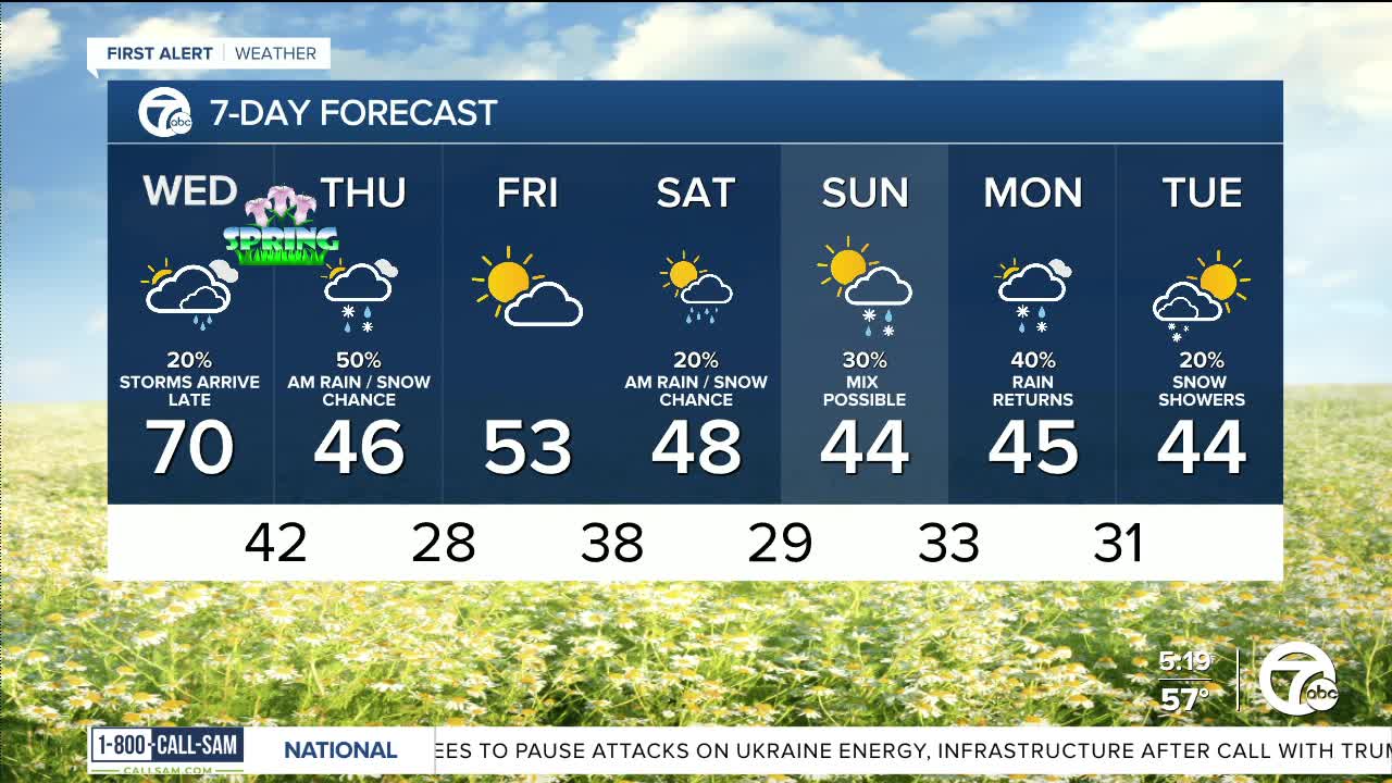
A storm system moves into the Midwest Wednesday and will bring rain, storms, and a wintry mix for southeast Michigan. Ahead of the storm system temperatures climb into the upper 60s Wednesday afternoon. Rain chances increase Wednesday evening, with a chance for thunderstorms after 10 PM. A few storms may be strong to severe, so stay with 7 First Alert weather for the latest updates.
On the backside of the system colder air will bring in a bit of a wintry mix with the final rain showers on Thursday. No accumulation is expected. Highs peak in the low to mid 40s Thursday.
Shower chances continue this weekend with highs in the 40s. It may be cold enough to add a few flakes Sunday.
Tonight: Mostly cloudy with lows around 50°. Winds: S 10 mph.
Wednesday: Mostly cloudy with a rain chance after 6 PM and a storm chance after 10 PM. Highs in the upper 60s. Winds: SSW 15-25 mph.
Thursday: Mostly cloudy with a chance of mixed showers. Most of the snow chances will be north of Detroit. The snow should not stick to the roads. Highs in the mid 40s and dropping late. Winds: NW 15-30 mph.
Current Conditions
- Humidity: 52%
- Dew point: 30°
- Pressure: 29.64 in
- Wind speed: 11 mph
- Wind direction: W
- Visibility: 10.0 mi
- Sunrise: 06:51 AM
- Sunset: 08:15 PM
